U.S. Geological Survey scientists warn that a single West Coast superstorm could flood much of California and rack up losses around $725 billion, dwarfing most disasters on record.
Story Snapshot
- U.S. Geological Survey modeled a realistic megastorm called ARkStorm, built from past events.
- Scenario shows statewide flooding, landslides, and weeks-long lifeline outages across major cities.
- Paleoclimate records show ancient rain episodes bigger than modern events, proving the hazard is real.
- Forecast tools for atmospheric rivers are improving, but preparedness gaps remain.
What ARkStorm Is, And Why It Matters Now
U.S. Geological Survey researchers built the ARkStorm scenario to test how California would handle a very large, but plausible, winter storm. They based it on the devastating 1861 to 1862 floods and modern atmospheric river science. The scenario chains multiple powerful storms. It drives extreme rain, landslides, levee failures, and long outages. The study estimates about $725 billion in losses from damage and disruption if such a storm hits today’s California.
Scientists stress that ARkStorm is not a date-specific prediction. It is a detailed “what if” to reveal weak spots in flood control, power, water, and roads. The point is to plan before the sky opens. That message crosses politics. Taxpayers on the right and left both pay when infrastructure fails. They also share the pain when broken supply lines raise food and fuel prices for months.
How A Megastorm Could Drown A State
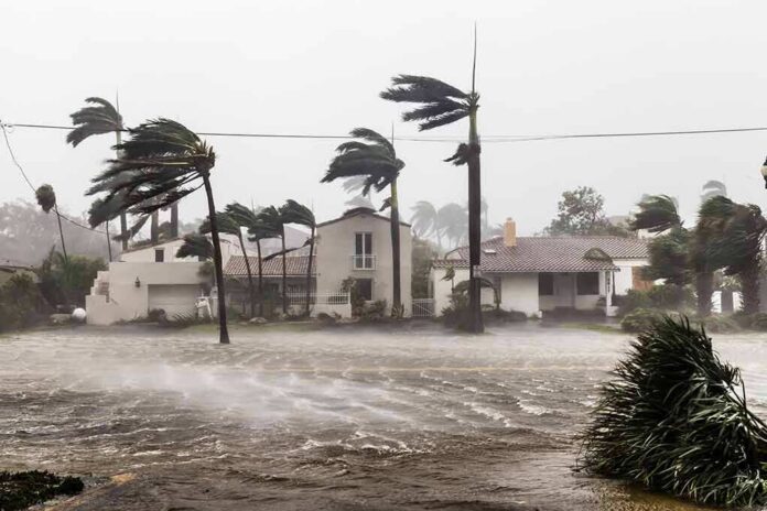
The ARkStorm footprint covers the Central Valley, the San Francisco Bay shoreline, Los Angeles and Orange Counties, San Diego, and many river towns. It shows thousands of square miles of urban and farm land underwater. It also shows thousands of landslides that block roads, rail, and pipelines. Lifelines like power, water treatment, and cell networks could be down for days or weeks in some areas. That scale goes far beyond a normal river flood.
Atmospheric rivers are the engine behind this risk. These narrow bands in the sky carry huge amounts of water vapor. When they stall over mountains and coastlines, they dump intense rain and raise flood odds. The National Oceanic and Atmospheric Administration runs a program to sharpen short-term rain, stream, and coastal flood forecasts tied to these storms. That effort aims to give cities and utilities more warning to act.
What History And Ancient Clues Tell Us
California has seen this kind of flooding before. The 1861 to 1862 storms turned the Central Valley into an inland sea and wrecked the state economy. U.S. Geological Survey teams used that history as a guidepost for ARkStorm. They also reviewed lake sediment records that track storm activity over about 3,000 years. Those records show extreme rainfall episodes larger than anything measured in recent times, proving the hazard is not new or imaginary.
That long record matters for today’s choices. It shows that rare does not mean never. Modern levees, roads, and suburbs now sit where ancient waters once spread. That raises exposure even if storm odds have not changed. It also means simple fixes will not be enough. Reservoir rules, levee upkeep, emergency plans, and land use decisions all shape how a future megastorm plays out.
Planning Gaps That Hit Every Household
Statewide flooding would test a patchwork of agencies and local districts. Responsibilities split across water, power, roads, and emergency services. That can slow action when minutes matter. The ARkStorm work points to needs that help everyone: stronger levees in key reaches, backup power for water treatment, better debris management to keep culverts clear, and clear evacuation maps people can use on a phone with low signal.
There’s a lot of hype about an extremely active and wet pattern in Northern California by mid-Nov. While that is a possibility, it’s not depicted very well by the ensembles. The EPS ensemble average shows a notably wetter than usual period in mid-Nov, but nothing alarming (It’s… pic.twitter.com/DSmZEYgHy8
— Western U.S. Weather Discussion (@o41036) November 3, 2026
Families can take simple steps now. Check flood maps and insurance options. Store two weeks of water and key meds. Keep paper copies of contacts and routes. Cities can run flood drills and clear known choke points each fall. Utilities can harden substation sites and share outage data in real time. These moves are not partisan. They lower losses whether the next winter brings steady rain or the kind of deluge ARkStorm describes.
Sources:
youtube.com, usgs.gov, cw3e.ucsd.edu, usatoday.com, psl.noaa.gov