
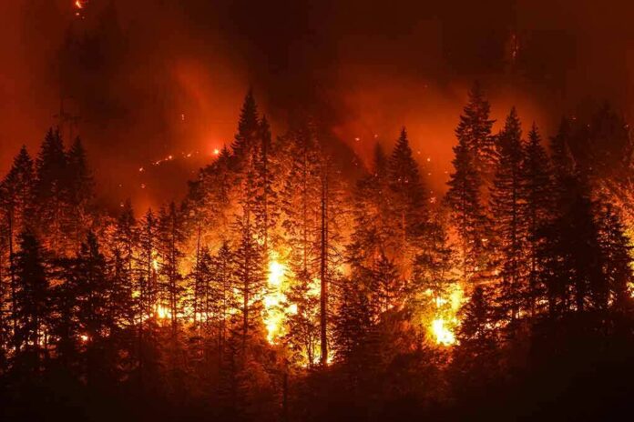
Fueled by hot, dry Santa Ana winds, the Norte Fire raced to 465 acres and burned homes in San Clemente and San Juan Capistrano, forcing evacuations and straining local defenses.
Story Highlights
- Officials reported 465 acres burned and homes damaged or destroyed near Via La Mirada.
- Evacuation orders covered zones in San Clemente and San Juan Capistrano.
- Wind-driven fire behavior made neighborhoods hard to defend.
- Damage counts may shift as formal inspections continue.
Fast-Moving Fire Hits Two Cities Along The Orange County Border
CAL FIRE reported the Norte Fire started on October 16 near Portico Del Norte and Eminencia Del Norte in San Clemente and quickly spread under hot, dry, windy conditions. The blaze reached about 465 acres within hours, pushing across canyons and into hillside neighborhoods that sit between San Clemente and San Juan Capistrano. Officials said homes were damaged or destroyed, with impacts clustered near Via La Mirada on the San Juan Capistrano side of the line.
Local fire officials and news outlets described wind-driven runs that jumped roads and pushed embers into roofs and decks, a known risk during Santa Ana events. Reporters on the ground counted at least six homes damaged in a hillside enclave, while state officials noted four homes “impacted” off Via La Mirada, a term that can include a range of damage levels. Early structure numbers often change as crews move from triage to detailed inspections.
Evacuations, Shelters, And A Rapid Operational Response
Authorities issued evacuation orders for San Clemente Zones 12 and 13 and for San Juan Capistrano Zones 4, 5, and 10, moving people out of wind-exposed streets and cul-de-sacs. Community centers opened as shelters while law enforcement managed traffic and kept people away from narrow fire roads. Air tankers and helicopters joined engines and crews to defend homes at the edge of brushy foothills where fire can funnel uphill fast.
Officials warned residents to leave quickly and not to wait for visible flames, since gusts can carry embers far ahead of the main front. That guidance reflects hard lessons from past Southern California fires, where fast spread has trapped drivers on tight canyon roads. Evacuation maps and zone codes helped direct families to routes and shelters with capacity. Those steps reduce chaos when minutes matter most.
Why Damage Numbers Differ In The First 24 Hours
CAL FIRE and local agencies use a damage scale that separates “affected,” “minor,” “major,” and “destroyed,” often based on the share of a structure lost. Reporters may say “damaged or destroyed,” while incident updates may list “impacted” until inspectors can verify details. That is why counts like “four impacted homes” and “six damaged” can both appear in early updates without being in conflict. Final tallies come after systematic surveys.
🚨 BREAKING: A fierce wind-driven wildfire (Norte Fire) is raging right behind homes in San Clemente & San Juan Capistrano, California. Homes destroyed as thousands face mandatory evacuations! ⚠️🔥 #CaliforniaFire #SanClemente #NorteFire #Wildfire pic.twitter.com/rPLvZ75T24
— Raita Meter (@raitameter) October 17, 2026
These early gaps matter to families, insurers, and city budgets. They also shape public trust. Clear terms and steady updates help people plan their next steps and avoid rumor-driven choices. Officials in Orange County faced classic Santa Ana conditions: steep slopes, dense brush, and neighborhoods built near open space. Those features demand better home hardening, cleared defensible space, and repeated drills so evacuations run faster the next time winds return.
Sources:
youtube.com, fire.ca.gov, abcnews.com, ktla.com, abc7.com